We've tried to ensure the information displayed here is as accurate as possible. Should there be any inaccuracies, we would be grateful if you could let us know at info@ipohworld.org . All images and content are copyright.
(Please click on the thumbnail for a bigger image.)
A Parit Flood - Part 1
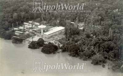
Much of the Kinta Valley is low lying land which has been subject to flooding for many years. This situation was made worse by the massive tin mining operations that the valley became famous for. As tin mining disturbed the surface of the land in the hills around the valley sediment was washed down into the rivers by thye heavy rains causing the rivers to become shallower and wider. Serious flooding followed throughout the valley. Parit, like Ipoh, suffered a lot from the flooding of the Perak River.
The 1967 pictures show, from left to right: An aerial view of the floods at their height.
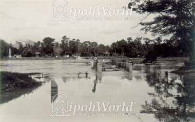
Next, the picture shows the flood on the Ipoh road which approaches the bridge.
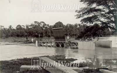
On the right, can be seen the seriously damaged pontoon bridge.
To go to Part 2, click here.
To see an earlier picture of the pontoon bridge, click here.